AIS Maps: Marine & Lake charts 6.4.0
Free Version
Publisher Description
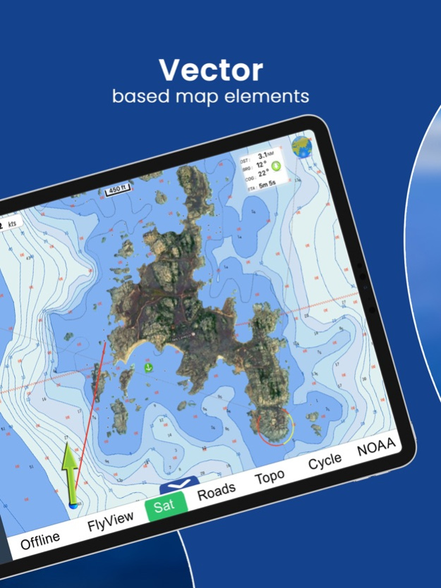

Discover a new perspective on the world with AIS Maps: Marine and Lakes Charts by FlyToMap. Our app is meticulously crafted, offering a seamless blend of aesthetic appeal and functionality. Witness the world in intricate detail, thanks to vector-based map elements that maintain their crispness even when zoomed in, and experience smooth panning, tilting, and rotating for a consistently immersive view.
Unlock the full potential of FlyToMap with our in-app purchase business model, providing access to a comprehensive array of maps, including Marine, Travel, Parks, and Lakes. All these maps are available for offline use at reasonable costs.
Key Features:
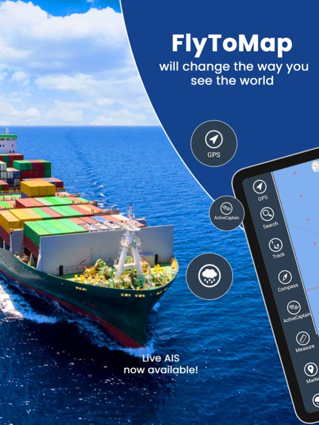
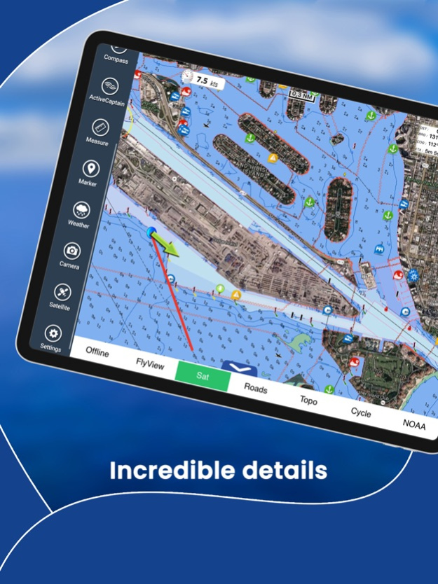
Live AIS Experience real-time map views of your boat and nearby vessels worldwide without the need for an AIS receiver—just your mobile device. Various icons denote different vessel categories, and selecting a target reveals detailed information such as name, MMSI, IMO, call sign, status, speed, heading, coordinates, distance from your GPS location, and more.
Free Features and Functions:
• Latitudes and Longitudes for easy navigation
• Direct search for your favorite points
• Intuitive zoom, rotate, and pan with a touch
• Quick object information with vector technology
• GPS heading for precise navigation
• Distance measurement tool for easy calculations
• Route planning with real-time speed, distance, and bearing updates
• Magnifying lens for detailed information
• Unlimited tracks, markers, geo-tagged photos, and records
• Shareable via email and visible on Google, Flytomap Viewer, and KMZ format
• Depth contours selection
• Background functionality for multitasking
• Optimized battery usage
• Local marine weather forecasts at your fingertips
Marine Maps: Explore detailed Electronic Nautical Charts (ENC) with information on coastline, anchoring areas, fishing spots, restricted areas, obstructions, rocks, buoys, beacons, lights, depth contours, spot soundings, and more.
Lake Maps: Access high-quality lake maps featuring depth contours, boat ramps, fishing spots, trails, roads, and railways information.
Park Maps: Discover advanced electronic charts with hiking, biking, and equestrian trails, as well as points of interest like campgrounds, visitor centers, lookout points, eateries, ranger stations, picnic areas, boat/canoe ramps, and parking areas.
Travel Maps: Explore the most captivating tourist areas, combining sea and land information for a comprehensive travel experience.
Stay connected with us:
• Twitter: @flytomap
• Web: flytomap.com
• Facebook: facebook.com/flytomap
Embark on a journey of exploration and navigation like never before with AIS Maps: Marine and Lakes Charts by FlyToMap.
Feb 8, 2024
Version 6.4.0
Charts added:
Georgian Bay South
Hudsonriver to Raritanbay
Lake Ontario West
Lake Huron South
Lake Erie East
Lake Huron North
Thousand Islands
Lake Ontario East
Prince William Sound
South Cook Inlet
Shelikof Strait
East Kodiak Island
East Andreanof Islands
About AIS Maps: Marine & Lake charts
AIS Maps: Marine & Lake charts is a free app for iOS published in the Recreation list of apps, part of Home & Hobby.
The company that develops AIS Maps: Marine & Lake charts is Flytomap. The latest version released by its developer is 6.4.0.
To install AIS Maps: Marine & Lake charts on your iOS device, just click the green Continue To App button above to start the installation process. The app is listed on our website since 2024-02-08 and was downloaded 5 times. We have already checked if the download link is safe, however for your own protection we recommend that you scan the downloaded app with your antivirus. Your antivirus may detect the AIS Maps: Marine & Lake charts as malware if the download link is broken.
How to install AIS Maps: Marine & Lake charts on your iOS device:
- Click on the Continue To App button on our website. This will redirect you to the App Store.
- Once the AIS Maps: Marine & Lake charts is shown in the iTunes listing of your iOS device, you can start its download and installation. Tap on the GET button to the right of the app to start downloading it.
- If you are not logged-in the iOS appstore app, you'll be prompted for your your Apple ID and/or password.
- After AIS Maps: Marine & Lake charts is downloaded, you'll see an INSTALL button to the right. Tap on it to start the actual installation of the iOS app.
- Once installation is finished you can tap on the OPEN button to start it. Its icon will also be added to your device home screen.
